Active
BO CARRIZALES
$2,900,000
Features:
Property Details
Remarks
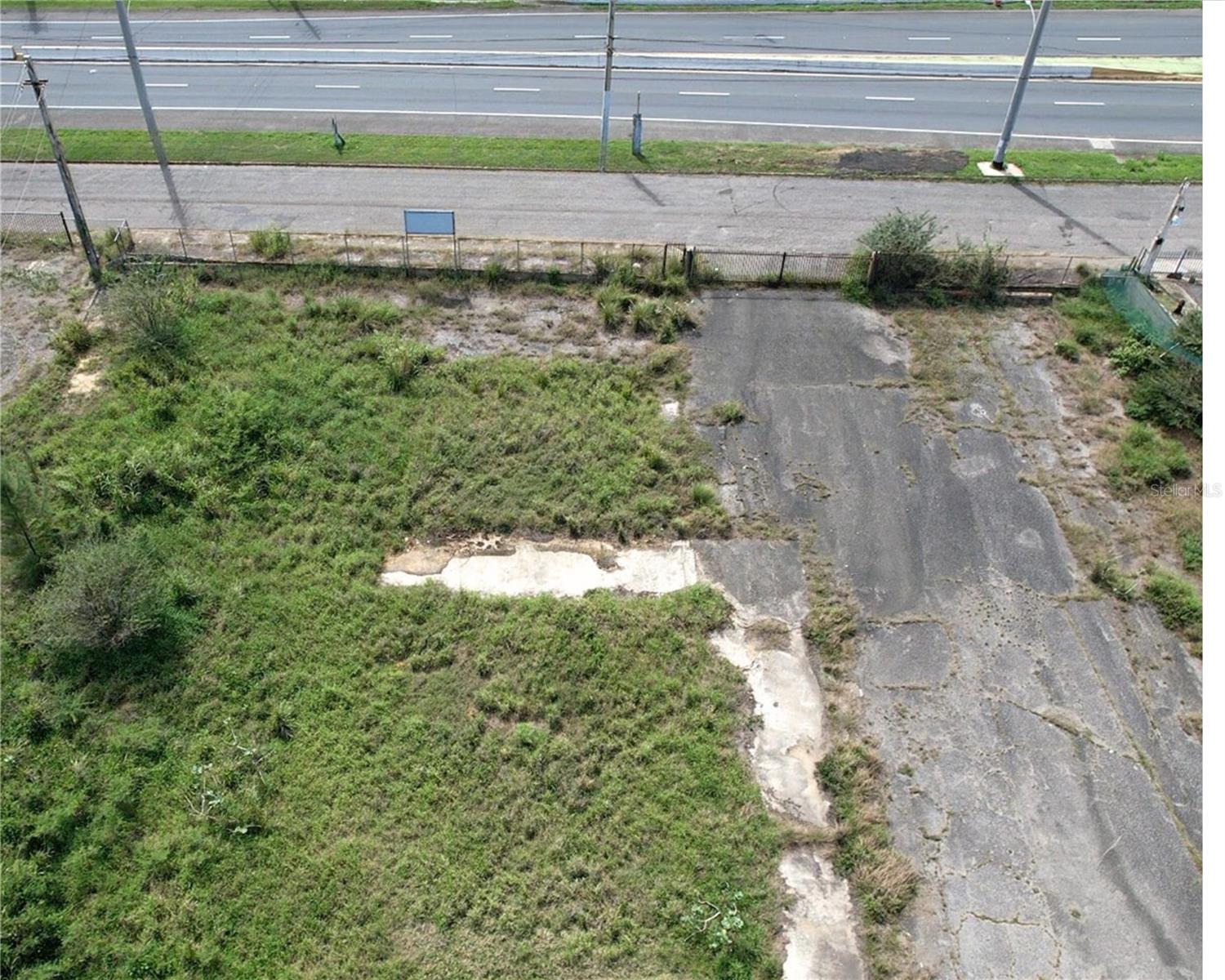
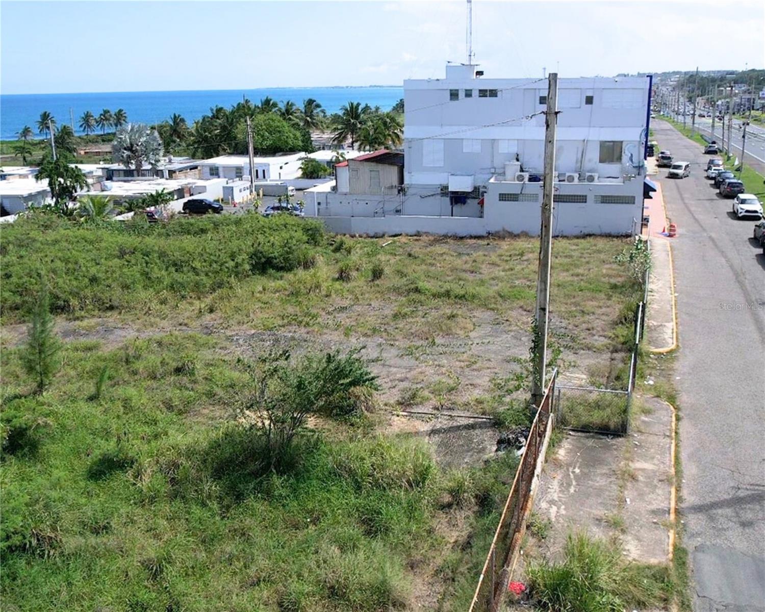
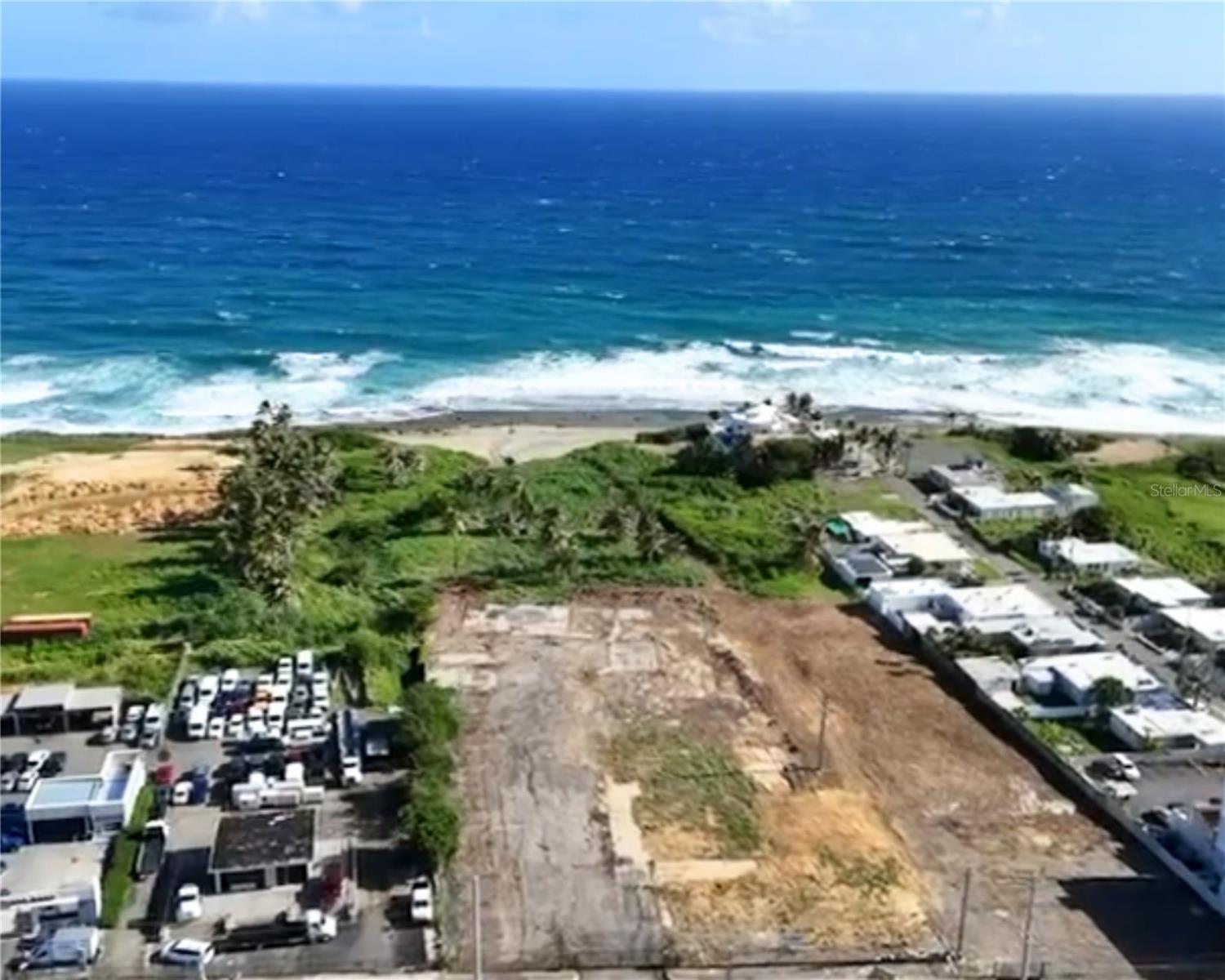
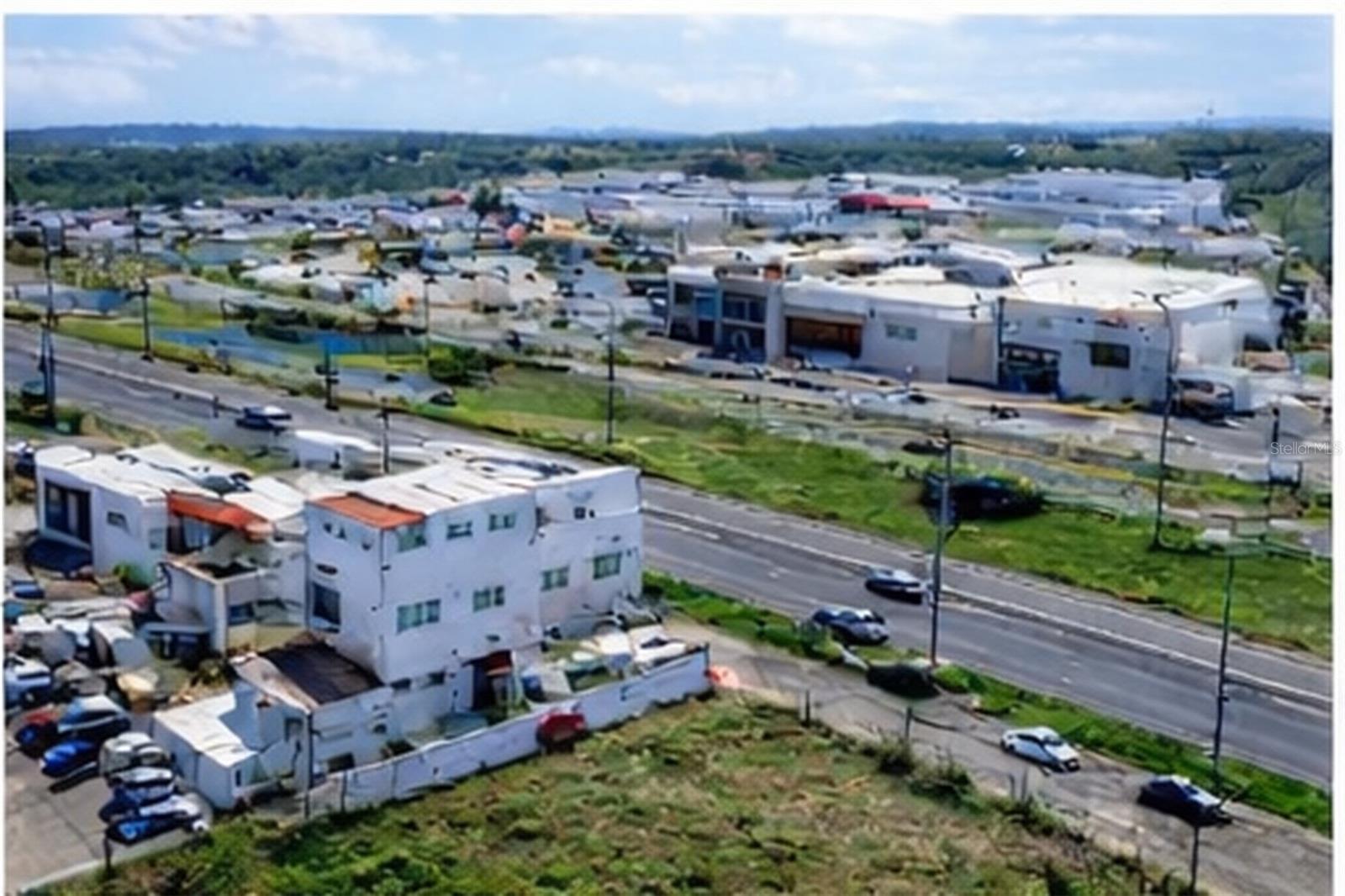
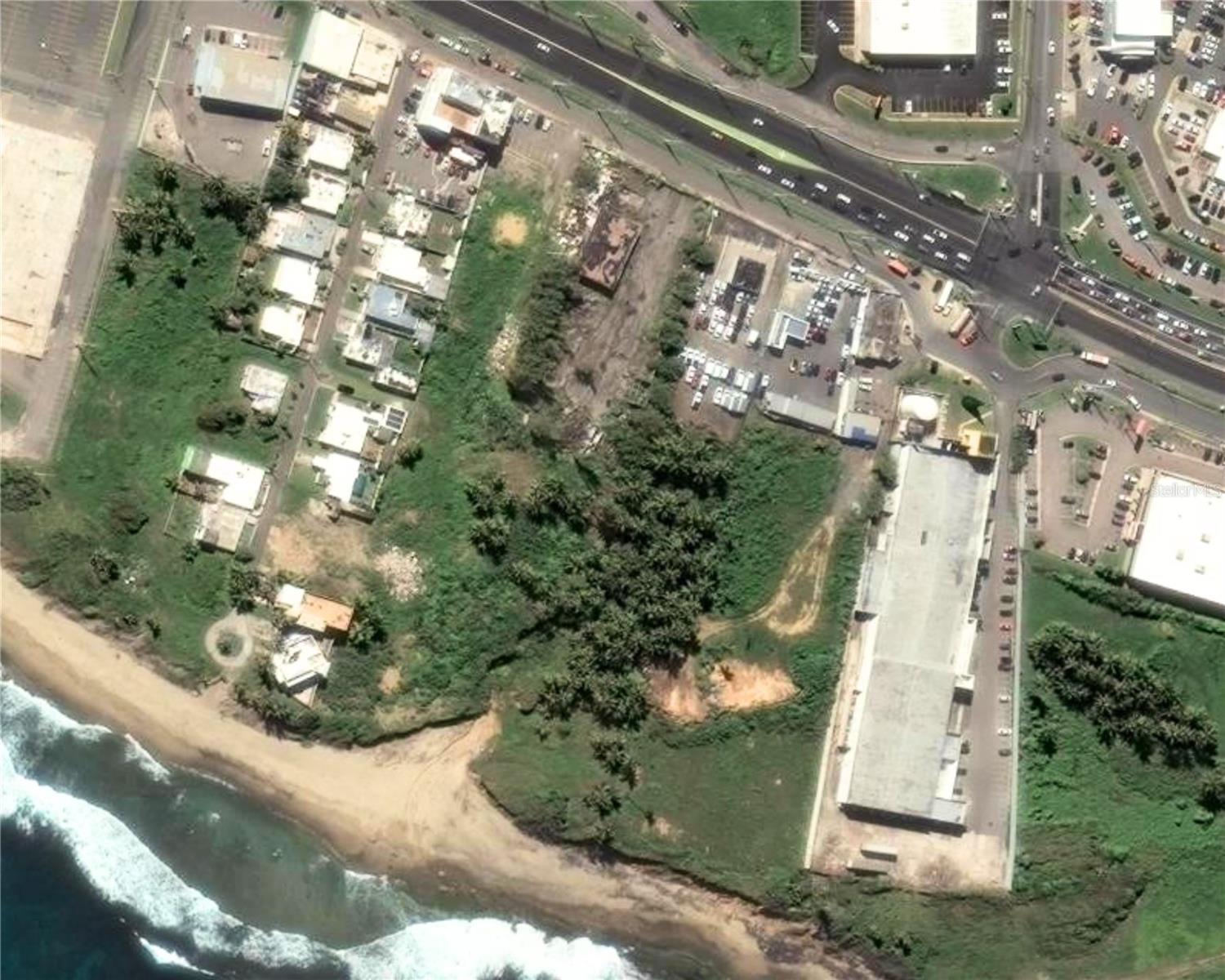
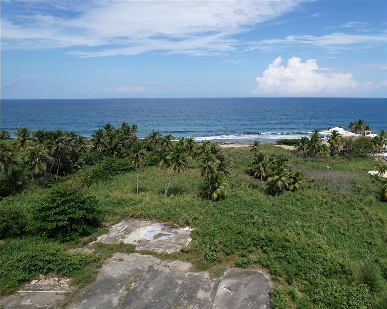
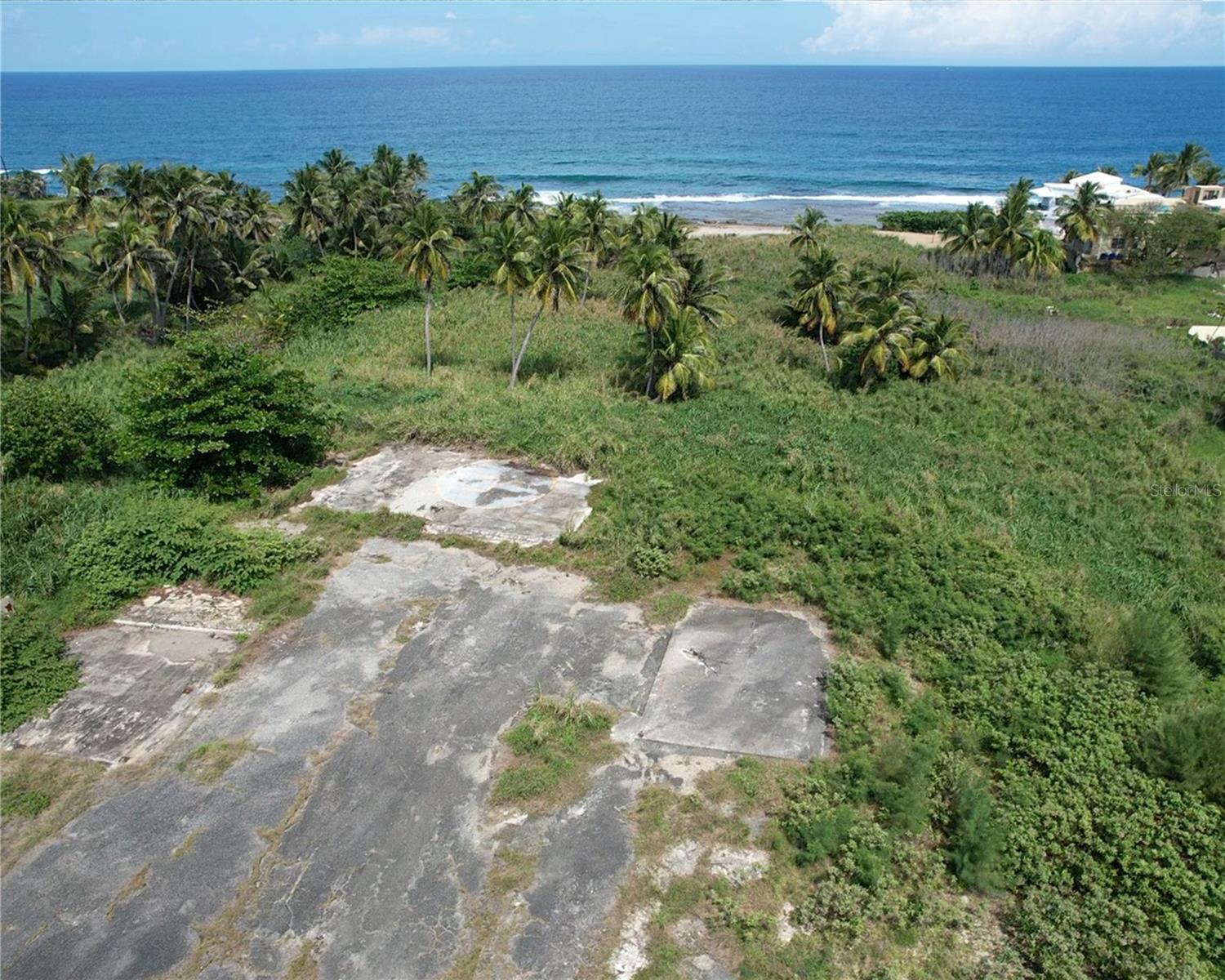
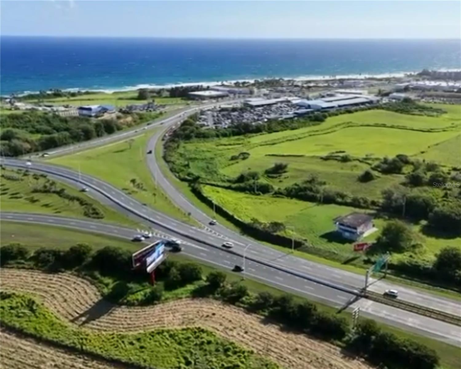
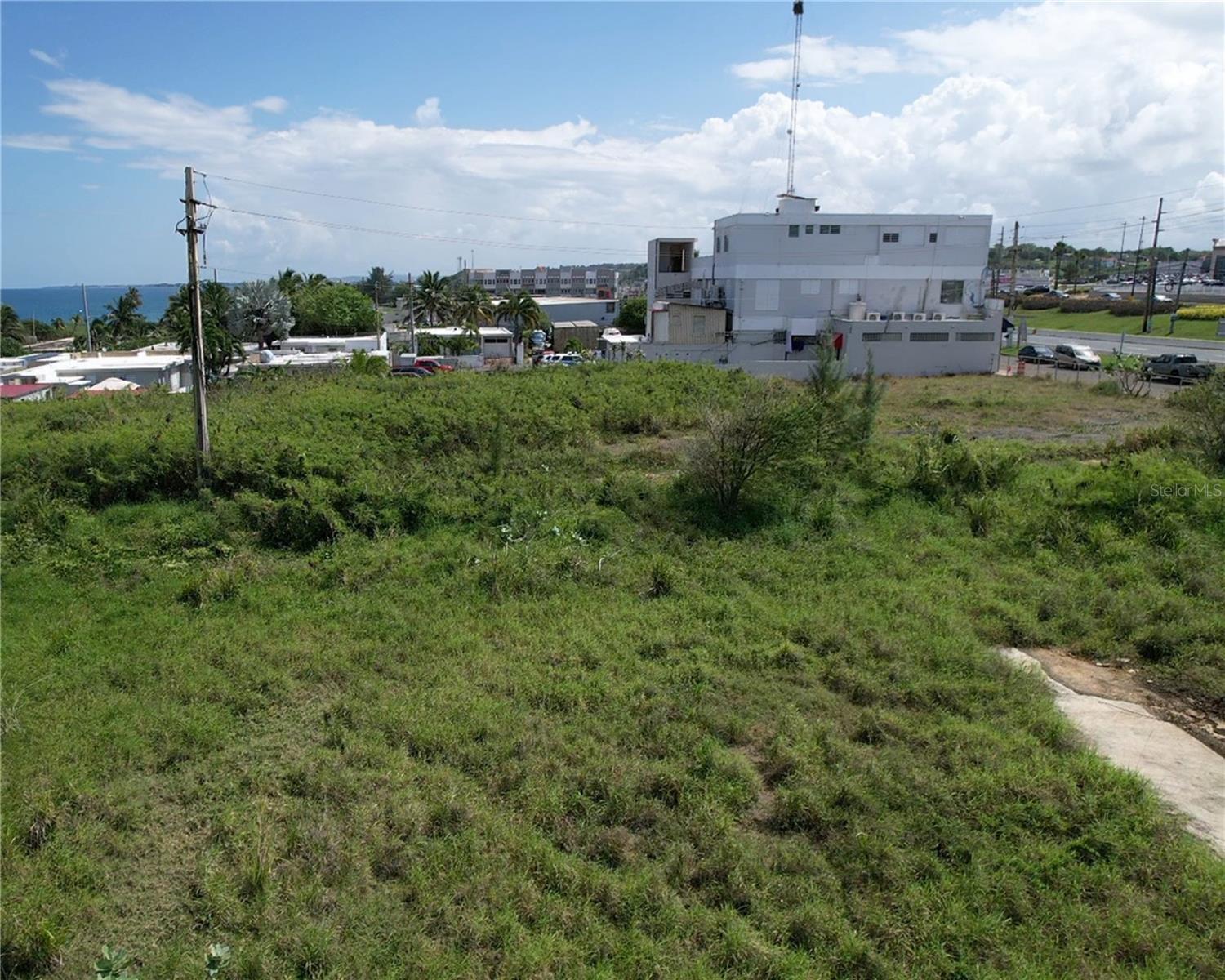
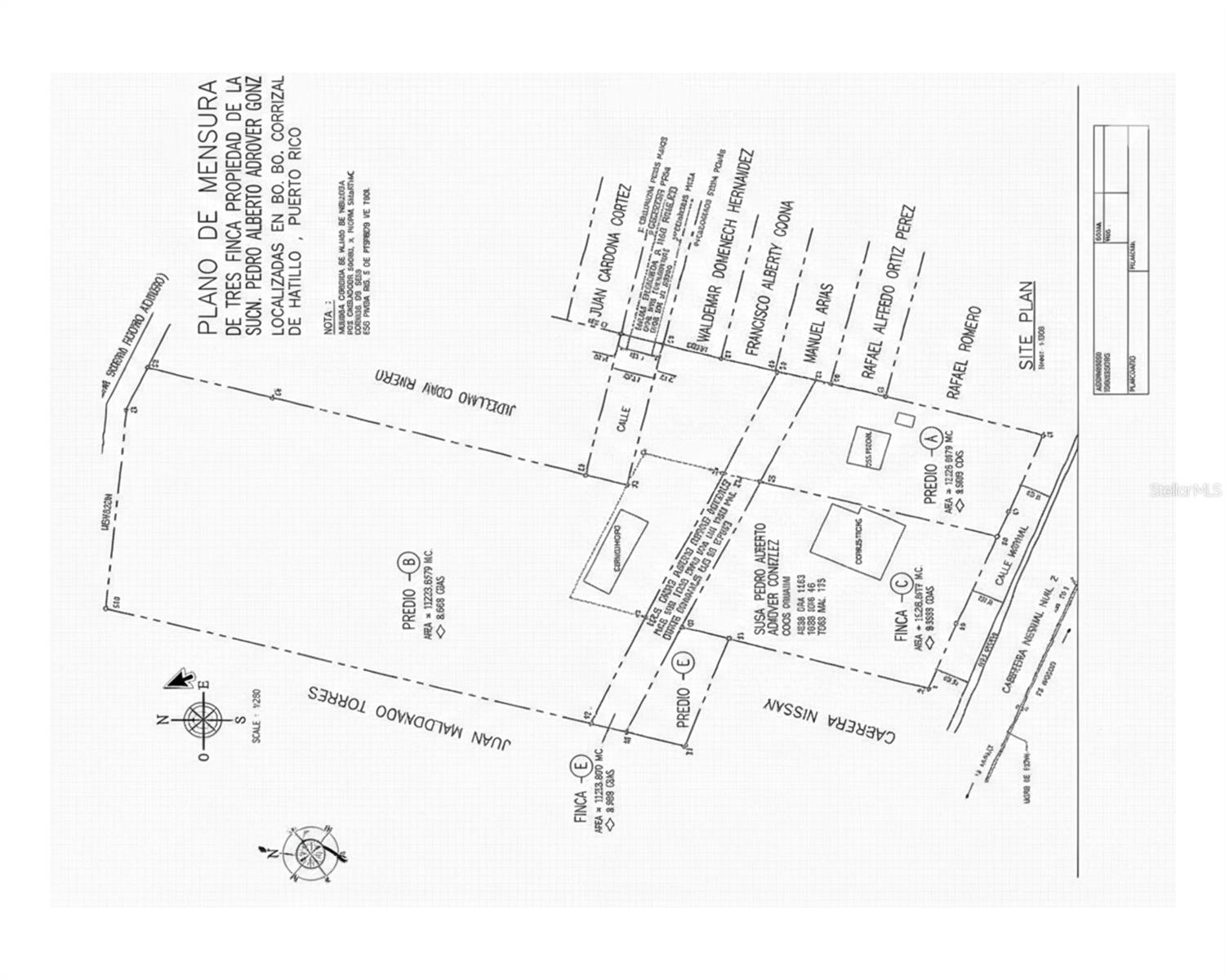
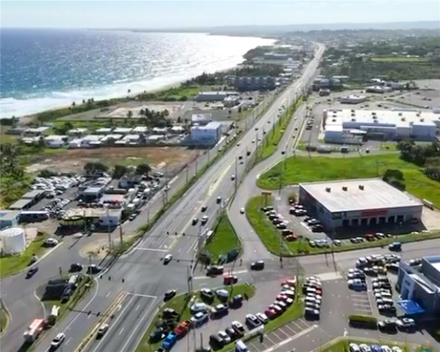
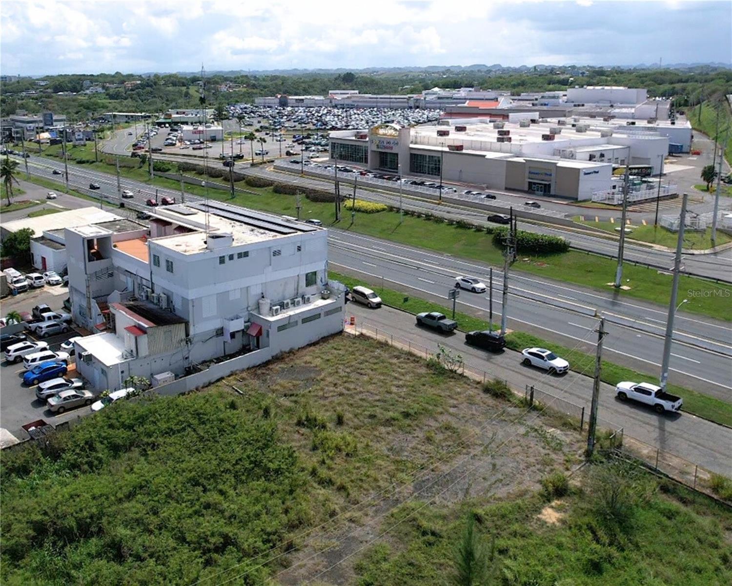
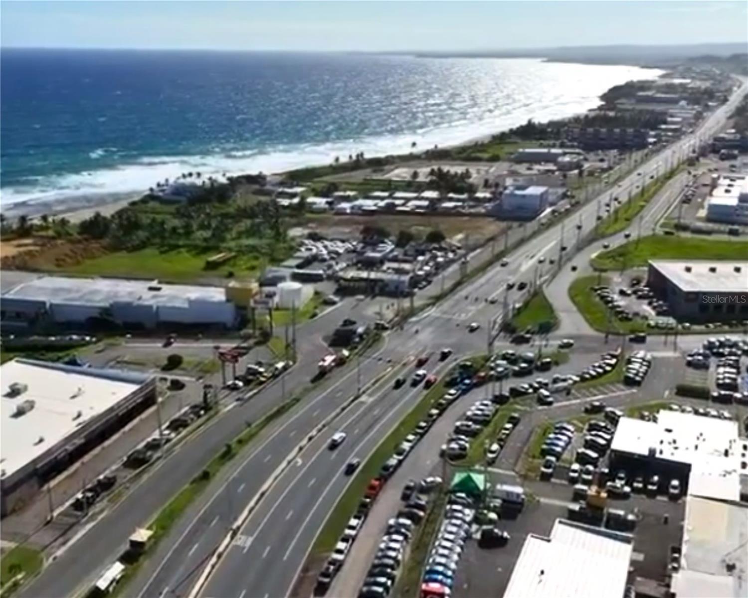
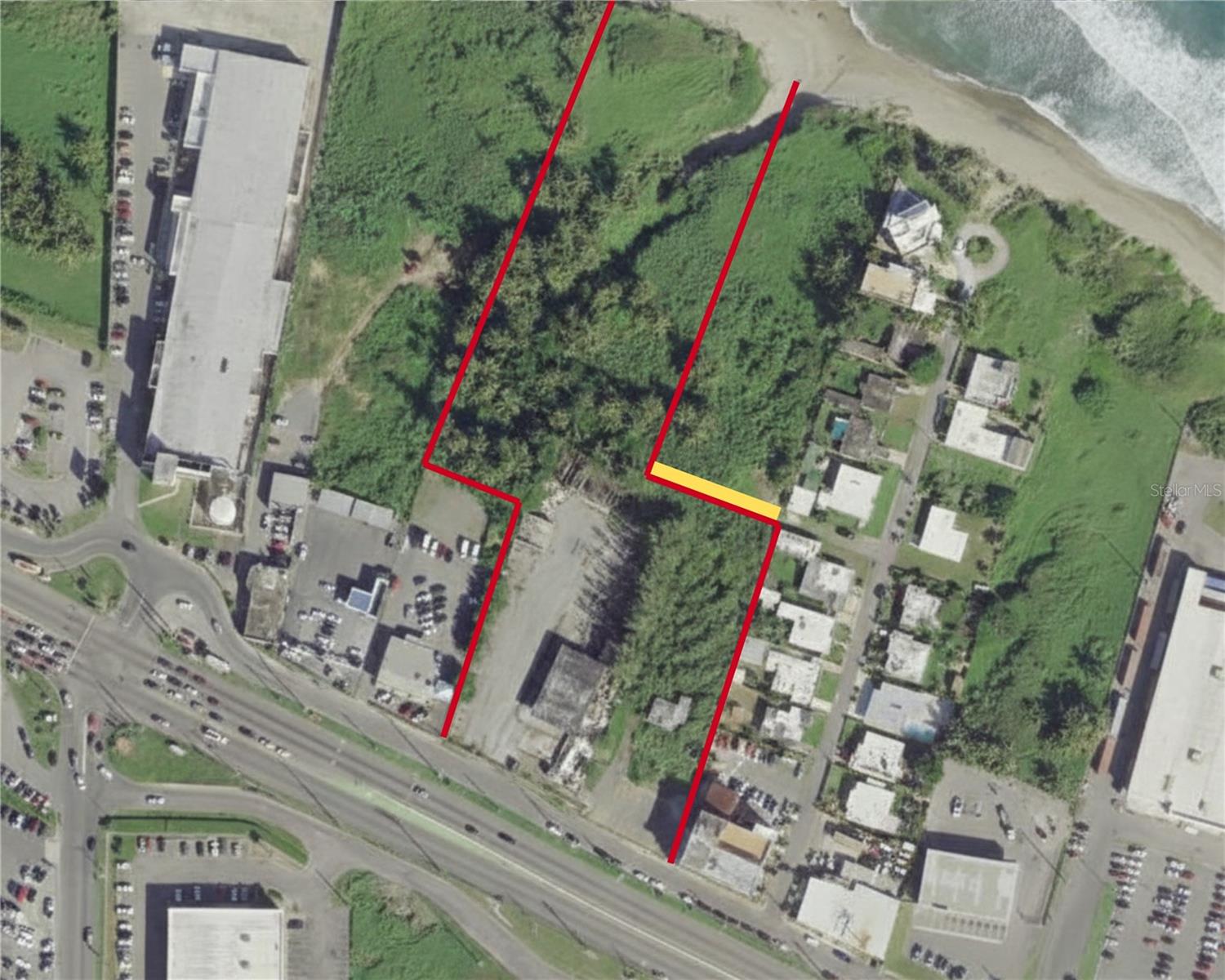
Strategic development opportunity consisting of three (3) land parcels identified as Parcel A, Parcel B, and Parcel C (Finca C), located in Carrizales Ward, Municipality of Hatillo, Puerto Rico, within an area designated for commercial and tourism-related development according to current zoning classifications. According to title records, the property contains approximately 5.54 acres, offering flexibility for integrated planning and scalable development. The assemblage allows multiple layout configurations suitable for commercial, tourism, or service-oriented projects subject to applicable permits. Parcel C (Finca C) features direct frontage along State Road PR-2, providing strategic visibility, vehicular accessibility, and commercial exposure. The property also offers ocean views, enhancing its scenic value and potential appeal for hospitality and tourism-oriented developments. ZONING AND REGULATORY FRAMEWORK: Zoning Classification: CT-I (Intermediate Commercial Tourist) Land Use Classification PT and PUT: SU (Urban Land) Overlay District: APE-ZC (Karst Special Planning Area) Not located within a floodway. Subject to Puerto Rico Land Use Plan, Tourism Interest Zones incorporated into the current Joint Regulation, and the Karst Special Planning Area Plan and Regulations (PRAPEC). PERMITTED USES (among others): Hotel, eco-lodging, tourist villas, condo-hotel, short-term lodging, professional offices, financial institutions, restaurants, retail uses, art galleries, gyms, daycare centers, vehicle rental, startups, specialized lodging and compatible tourism-related uses subject to applicable regulations. LAYOUT: Parcel C (Finca C) — Strategic frontage along PR-2 with existing structures as shown on the survey plan. Parcel B — Primary parcel as described in title records. Parcel A — Complementary parcel with public road access. POSITIONING: The combination of commercial-tourism zoning, significant land area, ocean views, and prime roadway exposure presents characteristics suitable for hospitality, commercial, service, and tourism-oriented development evaluation, subject to permits and approvals. NOTE: Areas, boundaries, and characteristics are subject to verification according to survey plans and recorded documentation.
Financial Considerations
Price:
$2,900,000
HOA Fee:
N/A
Tax Amount:
$N/A
Price per SqFt:
$13.5
Tax Legal Description:
N/A
Exterior Features
Lot Size:
214806
Lot Features:
N/A
Waterfront:
No
Parking Spaces:
N/A
Parking:
N/A
Roof:
N/A
Pool:
No
Pool Features:
N/A
Interior Features
Bedrooms:
Bathrooms:
0
Heating:
N/A
Cooling:
N/A
Appliances:
N/A
Furnished:
No
Floor:
N/A
Levels:
N/A
Additional Features
Property Sub Type:
N/A
Style:
N/A
Year Built:
N/A
Construction Type:
N/A
Garage Spaces:
No
Covered Spaces:
N/A
Direction Faces:
N/A
Pets Allowed:
No
Special Condition:
None
Additional Features:
N/A
Additional Features 2:
N/A
Map
- AddressBO CARRIZALES
Contact a Professional

Featured Properties
Related Properties
- Featured
- Active
7820 MIDNIGHT PASS
$ 989,000
- Featured
- Active
PR 6684 BUENA VISTA KM HM 2.5
$ 365,000
- Featured
- Active
466 LONG AND WINDING RD
$ 200,000
- Featured
- Active
BO ESPINAL
$ 200,000
- Featured
- Active
908 COCKRILL ST
$ 299,000
- Featured
- Active
PUNKIN CENTER RD
$ 549,900
- Featured
- Active
2ND ST E
$ 249,900
- Featured
- Active
11441 W BROWN PELICAN PATH
$ 979,000
- Featured
- Active
TBD NE 75TH ST
$ 469,000
- Featured
- Active
TBD NE 75TH ST
$ 395,000
- Featured
- Active
CALHOUN RD
$ 225,000
- Featured
- Active
7502 N 40TH ST