


Active
TBD NW 47TH CT
$250,000
Features:
Property Details
Remarks
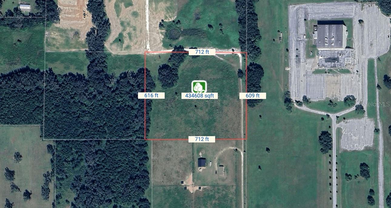
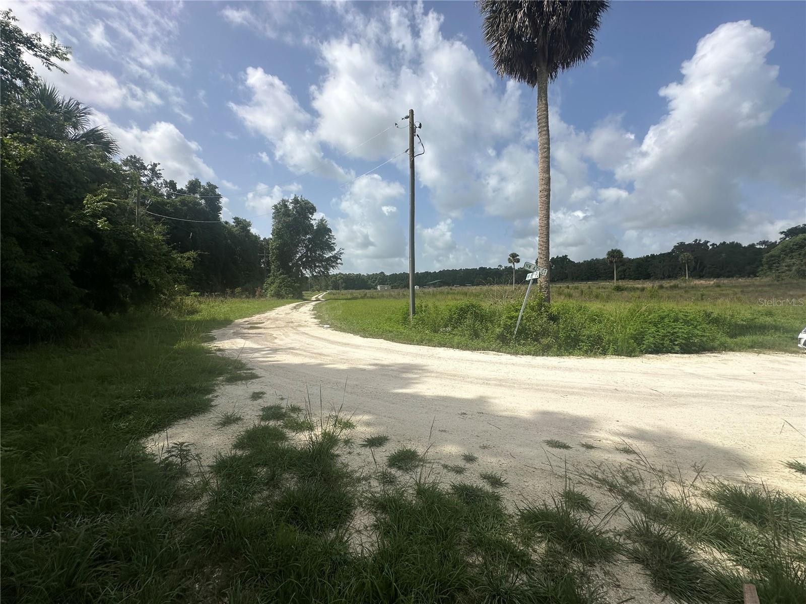
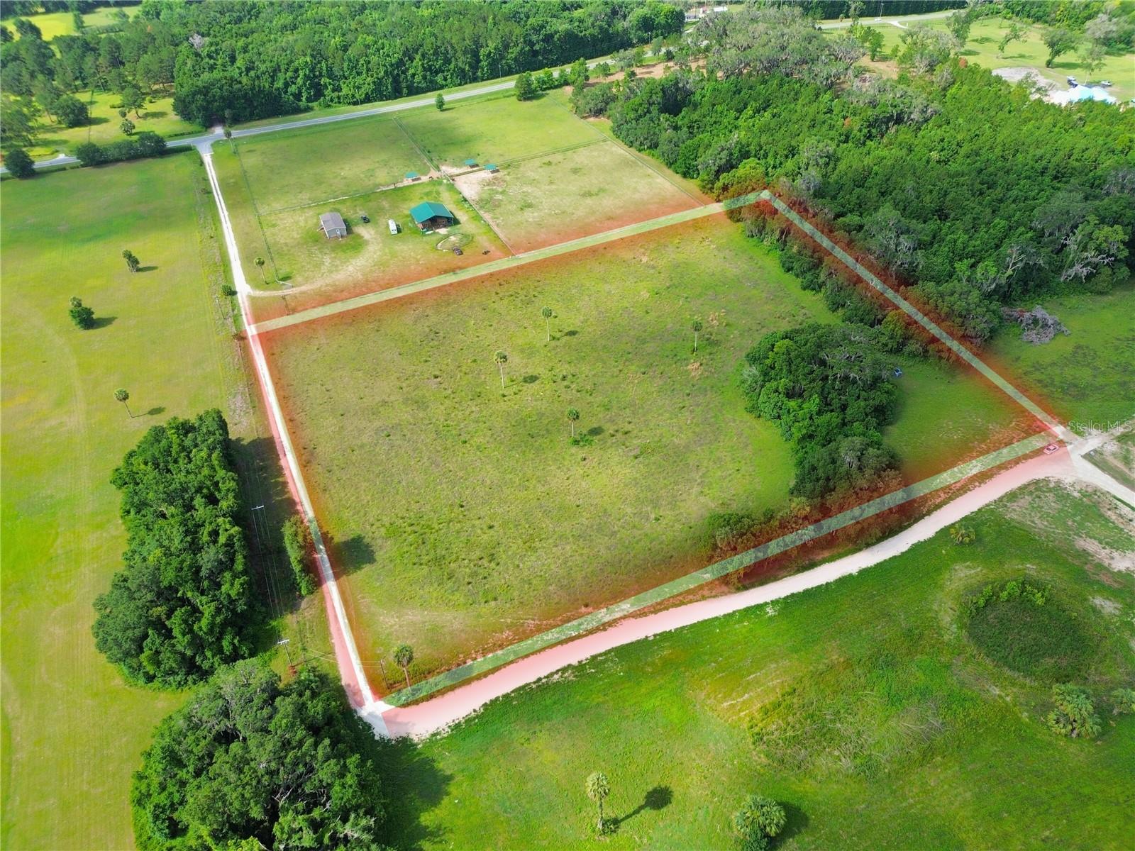
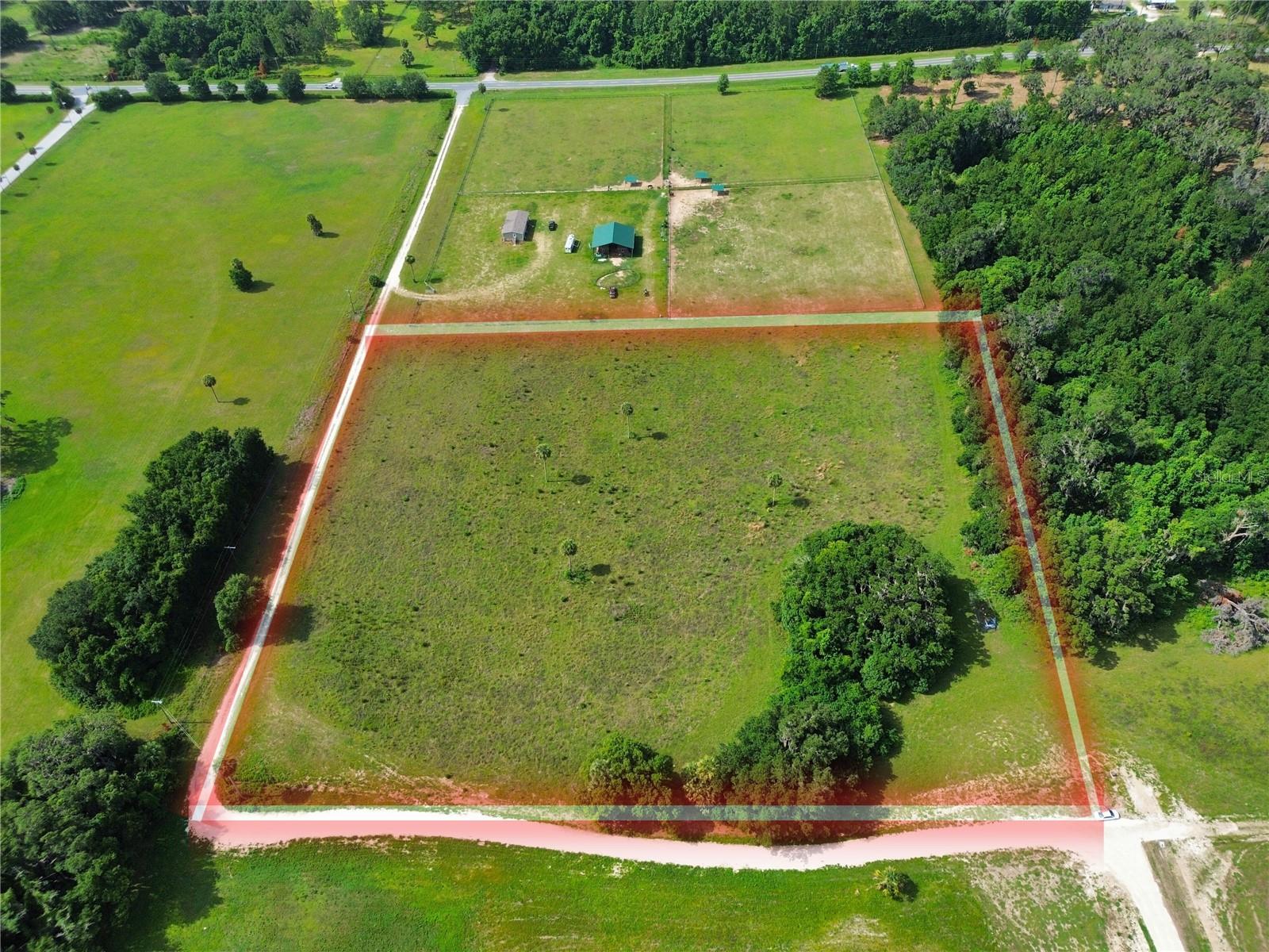
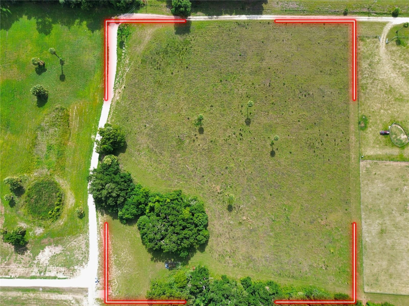
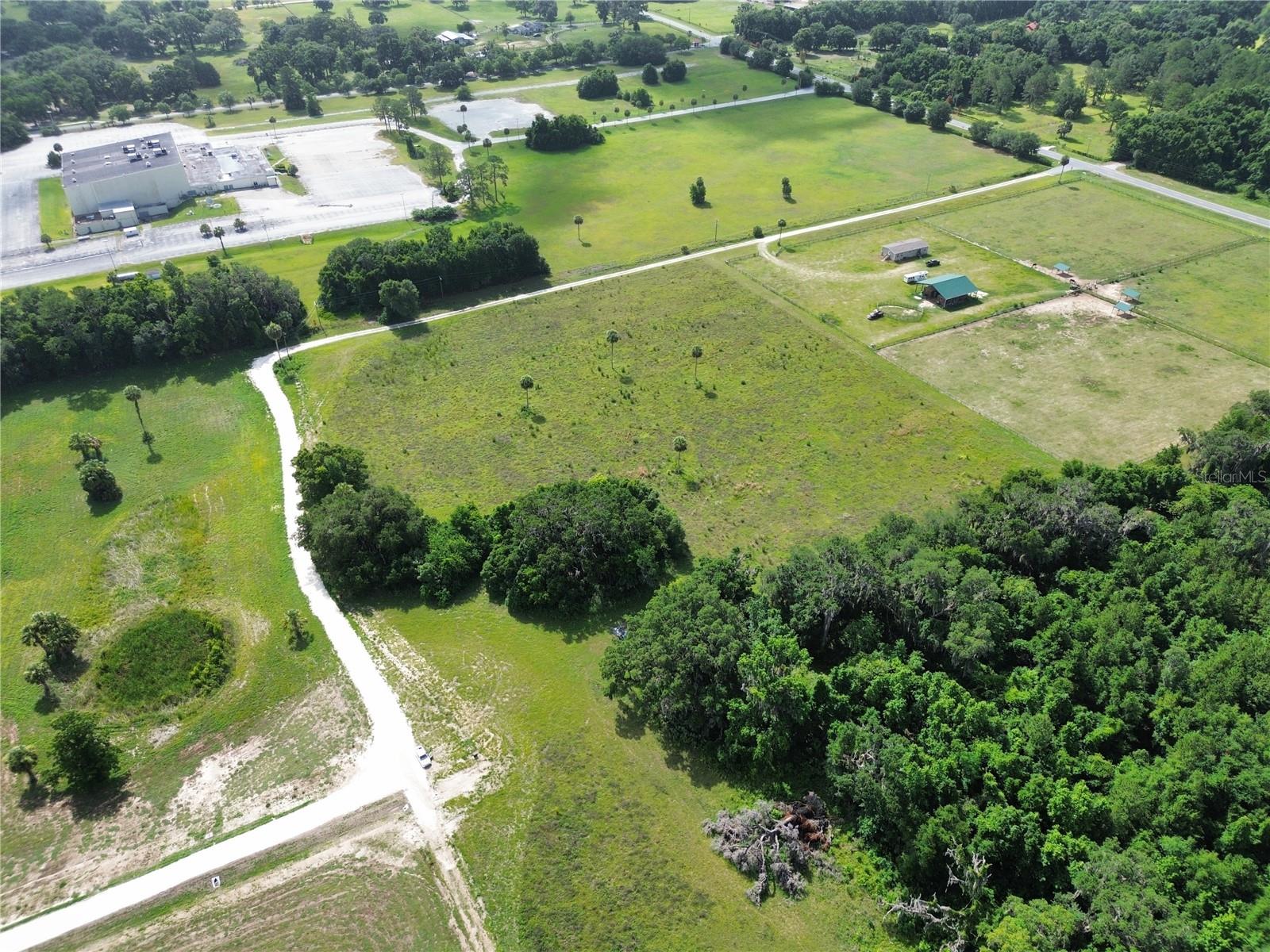
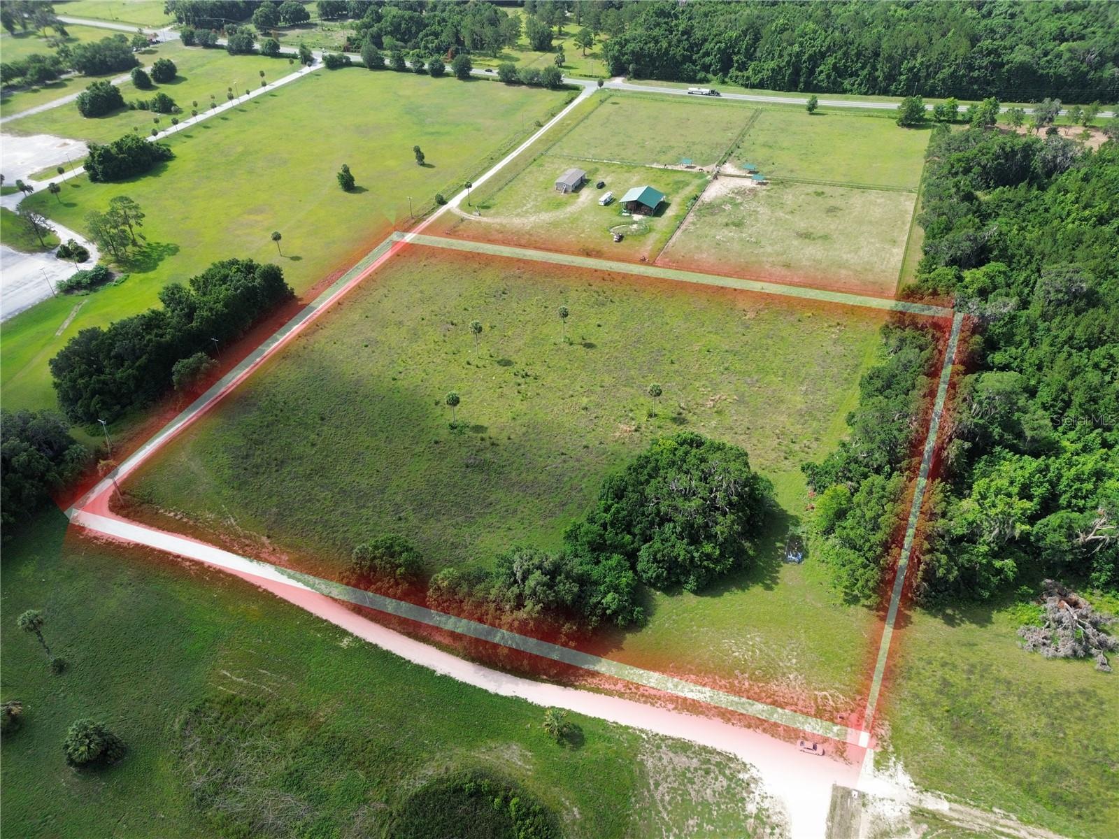
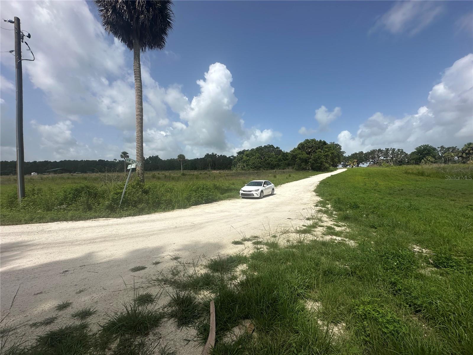
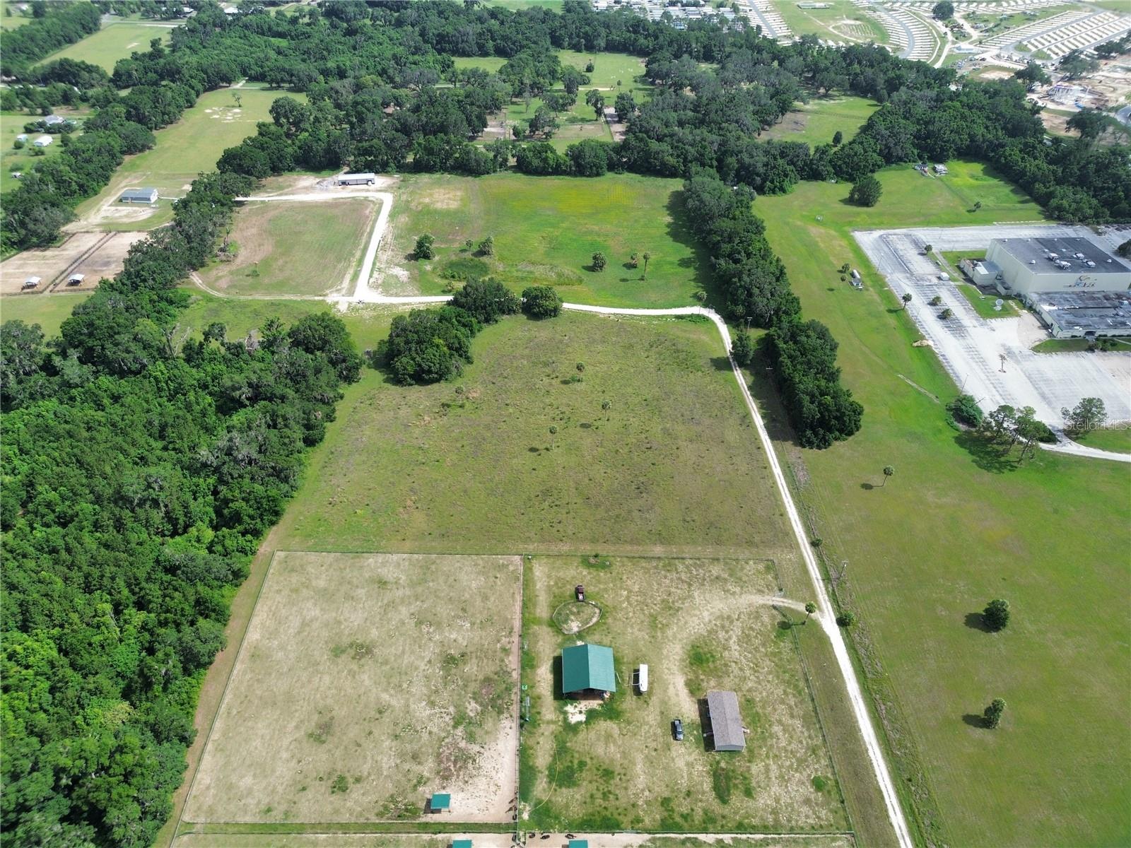
Open to owner financing. CLEARED 10-acre parcel ideal for residential, agricultural, or investment use. Zoned A-1 (General Agriculture) and situated in Flood Zone X, this property requires no flood insurance and presents excellent potential for building or farming. Electricity is provided by Duke Energy. Enjoy paved road access, quiet rural surroundings, and a central location between Ocala and Gainesville with convenient access to US-301. The lot measures approximately 609 ft x 712 ft x 616 ft x 17 ft, providing a generous footprint for a variety of uses. This property offers the perfect blend of space, utility, and location. Parcel ID: 02970-002-00 GPS Coordinates: Latitude 29.41323777 / Longitude -82.20464841
Financial Considerations
Price:
$250,000
HOA Fee:
N/A
Tax Amount:
$2288
Price per SqFt:
$0.57
Tax Legal Description:
SEC 27 TWP 12 RGE 21 BCC EASEMENT BOOK 001 PAGE 057 MAP BOOK 002 PAGE 325 SABAL RIDGE FARMS LOT 2 DESC AS FOLLOWS: COM AT SE COR OF SE 1/4 OF SEC 28 TH N 00-20-57 E 60 FT TO PT ON N ROW OF HWY 318 TH N 89-47-08 E 63.03 FT TH N 659.62 FT TO POB TH W 5 0.22 FT TH N 614.05 FT TH E 16.18 FT TH S 3.33 FT TH E 700.50 FT TH S 00-17-31 W 607.38 FT TH S 89-42-40 W 663.37 FT TO POB. TOGETHER WITH INGRESS/EGRESS & UTILITY EASEMENT DESC AS FOLLOWS: COM AT SE COR OF SE 1/4 OF SEC 28 TH N 00-20-57 E 60 FT TH N 89-47-08 E 663.03 FT TO POB TH N 00-17-31 E 1238.11 FT TH W 588.39 FT TO PT OF CURVATURE OF A NON TANGENT CURVE CONCAVE E HAVING A RAD OF 60 FT & CENTRAL ANGLE OF 300-00-00 TH WLY, NLY & ELY ALG ARC OF CURVE 314.16 FT CHORD BEARING & DIS OF N 60 FT
Exterior Features
Lot Size:
435600
Lot Features:
Buildable, Cleared, Oversized Lot
Waterfront:
No
Parking Spaces:
N/A
Parking:
N/A
Roof:
N/A
Pool:
No
Pool Features:
N/A
Interior Features
Bedrooms:
Bathrooms:
0
Heating:
N/A
Cooling:
N/A
Appliances:
N/A
Furnished:
No
Floor:
N/A
Levels:
N/A
Additional Features
Property Sub Type:
N/A
Style:
N/A
Year Built:
N/A
Construction Type:
N/A
Garage Spaces:
No
Covered Spaces:
N/A
Direction Faces:
N/A
Pets Allowed:
No
Special Condition:
None
Additional Features:
N/A
Additional Features 2:
N/A
Map
- AddressTBD NW 47TH CT
Contact a Professional

Featured Properties
Related Properties
- Featured
- Active
4103 STANLEY RD
$ 889,000
- Featured
- Active
681 S COUNTY ROAD 315
$ 320,000
- Featured
- Active
1405 6TH ST SE
$ 1,800,000
- Featured
- Active
10702 OSPREY LANDING WAY
$ 499,900
$ 3,500,000
- Featured
- Active
320 GRIGSBY RD
$ 1,800,000
- Featured
- Active
2780 N FLORIDA AVE
$ 275,000
- Featured
- Active
E TWITTY RD
$ 2,013,960
- Featured
- Active
SPRING LAKE HWY
$ 395,000
- Featured
- Active
HARRIS RD
$ 315,000
- Featured
- Active
672 HWY
$ 375,000
- Featured
- Active
971 KM 14.5 BO. DUQUE